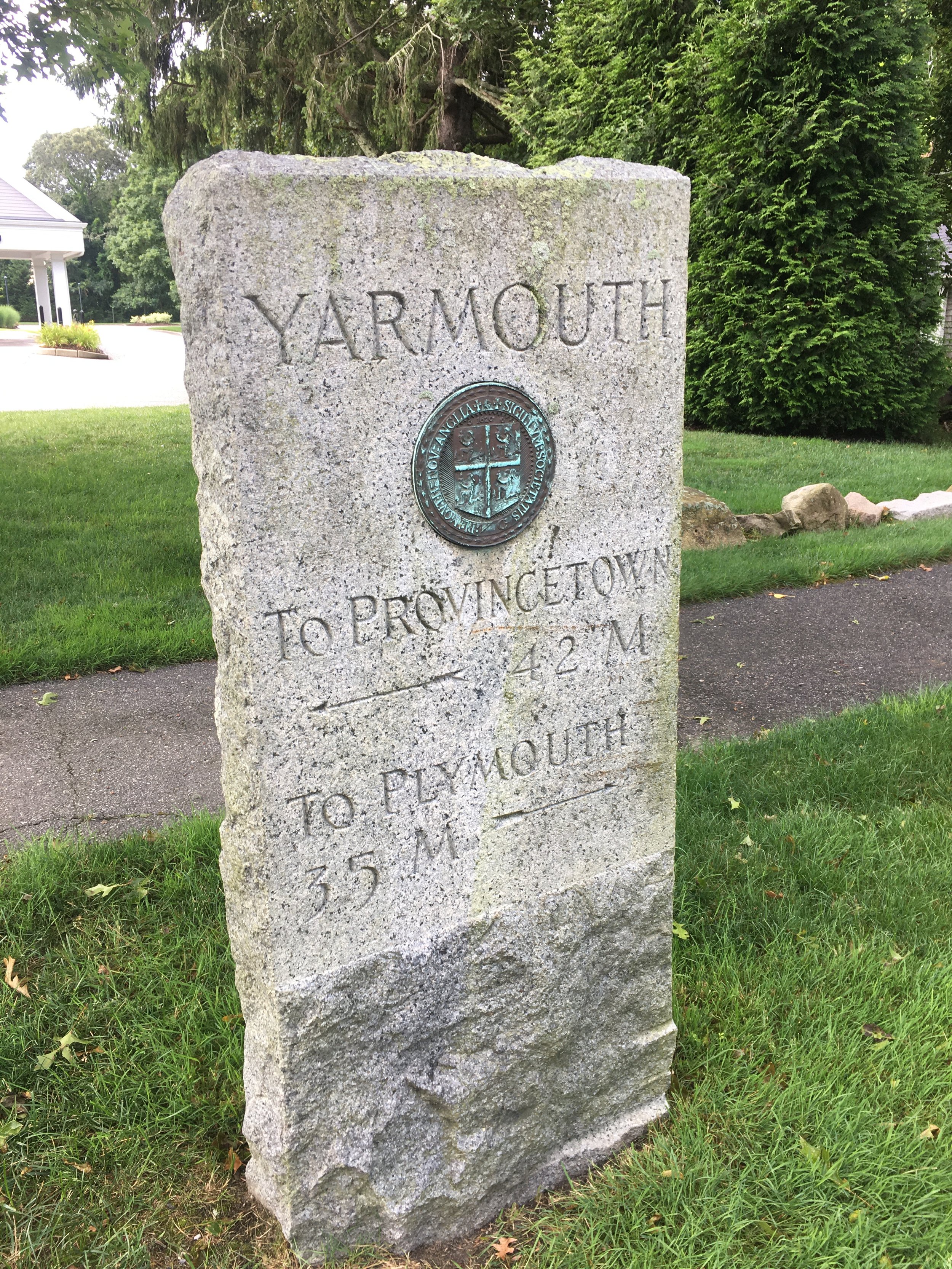
Nearly hidden by today’s tall grass and bushes are some 18th century milestones along Route 6A. In the early 1700’s Old King’s Highway (now Route 6A) was the major road connecting Cape towns to the county seat at Barnstable, and then on to Plymouth and Boston. The first milestones came as the result of an act in 1724, “Intitled An Act for High Ways, made in the fifth year of the Reign of King William and Queen Mary.” This act required the “Select-Men” of the various towns of Massachusetts to appoint surveyors as well as for “repairing and amending from Time to Time, all High-Ways”. Interestingly, the act did not prevent the towns from defraying the charge of these repairs by rates or taxes, which meant that toll roads could have created if the towns so wished. Another chance for Yankee frugality to show itself!
As with anything that had costs associated with it, towns took their time with this new law, and it wasn’t until 1729 that the first real markers appeared along the side of the road. They appeared on the right hand side leading from the shire town or the colonial capital. These small stones, some no more than two feet high, were carved as cheaply as possible out of local granite boulders. In Yarmouth one stone is located one house west of the intersection of Union Street and 6A. It has chiseled into it, “B 4 1729.” The marker indicates that it is four miles from the county seat at Barnstable village. The location was also a known stage stop.
477 Route 6A, Yarmouth Port
Unfortunately, it doesn’t appear that any milestones still remain in the town of Dennis. Barnstable still has five markers, but only one bears a date of 1729 and that is just beyond Mary Dunn Road heading to Barnstable village. It reads, “B 74 1729”, the B in this case referring to Boston.
In spite of its good intentions, the 1724 law failed to get all towns to improve their roads. In the 1750’s, Benjamin Franklin traveled widely throughout what is now northeastern United States to help establish postal routes and rates. Milestone markers would allow standardization of postal rates as well as stagecoach fees by charging by the mile. The result of his efforts were more milestone markers. Just east and across the street from the John Gorham house in Barnstable, not far from the Yarmouth town line, is a marker which supposedly reads, “ B 75 P 53 C.Cod 54 1759.” There has been damage to the stone, probably by frost, and only the B is still visible. The C. Cod refers to Provincetown, which was called Cape Cod before its incorporation in the 1720’s. Habits change slowly, and new town name probably took a generation to become well used. Before its incorporation, Provincetown was part of Truro and was known locally known as “Hell Town,” the harbor being known to mariners as “Tophet’s Mouth.” This was a biblical term denoting hell. Provincetown’s reputation started to improve only after shore whaling died out in the 1730’s and more residents came to live there.
Ben Franklin failed to get all Massachusetts towns to cooperate, and the need for road improvements continued. Some towns were fined in the late 1760s for not maintaining roads 2 ½ rods wide. This is the origin of the 40 foot road width. There are no records yet found which have indicated any Cape towns being fined. Some towns turned to the tavern owners to help with markers and several throughout Massachusetts Colony have the milestones with date and miles, along with the tavern owner’s initials or names. The Bay Road, running from Taunton to Boston has several milestones, all dated 1773, which contain the initials of the closest tavern owner. Yankee frugality again showed itself, as towns managed to get others to pay for required work, in this case the tavern owners.
No further changes took place before the American Revolution. After the Revolution, transportation changes lessened the need for more milestones. However in the 2000s another milestone was discovered just east of Parnassus Bookstore, almost across from the entrance to the Yarmouth Port Post Office. There is a stone wall separating Parnassus with the house immediately to the east, and the marker is right at the end of the wall near the road, immediately east of the wall. It was neither a mile marker for stages in the 18th century, nor a boundary marker between towns. This marker is carved in a granite stone and reads:
G T T
BOSTON
76 MILES
1880
In 1880 a George T. Thacher lived behind the Col. John Thacher house and we can only assume George placed the marker there, perhaps to let people know where he lived, and he may have decided to make it look like other milestones in the area. If it had an official function, we aren’t aware of what it was.
Today, these quiet little markers sit unnoticed and virtually unchanged. They are just another wonderful reminder of our early heritage.
Researched & written by Jack Braginton-Smith and Duncan Oliver
You can view more Massachusetts milestones on this site.


